FLORIDA — Just when some Florida communities were beginning to recover from serious flooding earlier this month, another round of heavy rainfall is approaching the state’s Atlantic coast.
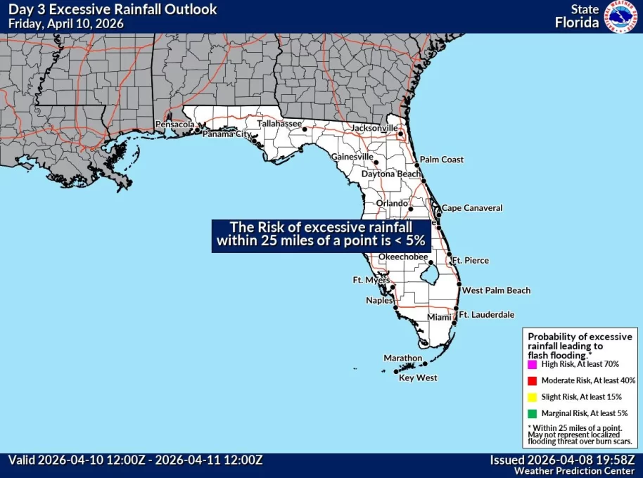
The National Weather Service (NWS) Weather Prediction Center has issued a Slight Risk of excessive rainfall, Level 2 of 4, for portions of eastern Florida beginning Tuesday, November 17, 2026.
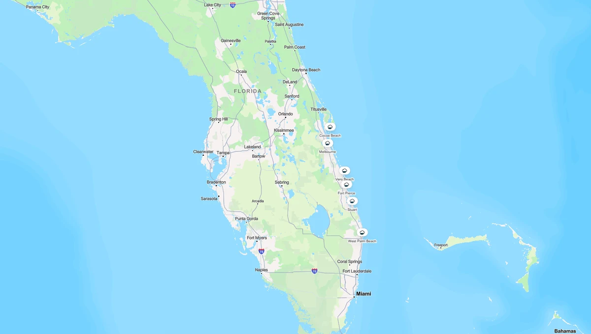
The areas of concern include parts of the Space Coast, Treasure Coast, and Gold Coast, particularly communities stretching from around Cape Canaveral and Cocoa Beach south toward coastal Palm Beach County.
Forecasters warn that repeated bands of heavy showers and thunderstorms could produce localized flooding, especially where drainage systems are already under pressure.
The timing is particularly concerning because parts of East Central Florida experienced exceptional rainfall and flooding earlier in November.
And with several waterways still above flood stage, another prolonged period of rain could create additional problems for residents.
Here’s what the latest official forecasts say about the November 17–21 rain threat, which Florida communities should pay attention, and how to prepare.
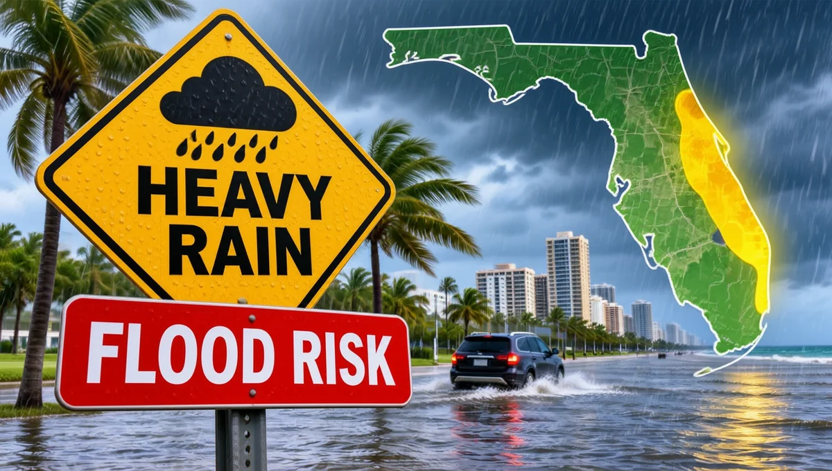
Why Is Florida Facing Another Heavy Rain Threat?
According to the Weather Prediction Center’s November 15 forecast discussion, a slow-moving upper-level weather disturbance is expected to move across the Florida Peninsula during the week.
At the same time, strengthening easterly winds will carry moisture inland from the Atlantic Ocean.
This combination can create conditions favorable for repeated showers and thunderstorms.
The concern is not simply that one thunderstorm might produce heavy rain.
Instead, several rounds of rainfall could affect the same locations over an extended period.
Meteorologists sometimes call this training, when showers or thunderstorms repeatedly move over the same area.
When that happens, rainfall can accumulate faster than streets, storm drains, and waterways can handle.
The Weather Prediction Center specifically highlighted the potential for localized flooding along Florida’s eastern coastline.
When Will the Heaviest Rain Hit Florida?
The forecast indicates that rain chances will increase early in the week, with the most concerning period expected around Wednesday and Thursday.
Tuesday, November 17
Rain chances are expected to increase across eastern Florida.
Scattered to numerous showers may develop, with some locations experiencing periods of locally heavy rainfall.
The Weather Prediction Center’s Day 3 outlook identifies a Slight Risk of excessive rainfall for parts of the eastern Florida Peninsula during the period extending from Tuesday morning into Wednesday morning.
Wednesday, November 18
Wednesday is one of the main days to watch.
Forecast guidance suggests that persistent Atlantic moisture and repeated showers could increase the risk of flooding along portions of the coast.
Areas from the southern Space Coast through the Treasure Coast and toward Palm Beach County deserve particular attention.
Thursday, November 19
The flooding threat may continue Thursday as the weather disturbance remains near Florida.
Additional rainfall could aggravate drainage problems in communities that received heavy rain earlier in the week.
The NWS Melbourne office has identified Wednesday and Thursday as the period with the greatest flooding potential along the coast south of Cape Canaveral.
Friday, November 20, and Saturday, November 21
Unsettled weather may continue into the latter part of the week.
However, the location and intensity of the heaviest rainfall become less certain farther into the forecast.
Residents should monitor updated forecasts rather than assume the same conditions will persist throughout the entire November 17–21 period.
Which Florida Areas Face the Greatest Flooding Concern?
The official excessive rainfall outlook highlights portions of Florida’s Atlantic coast.
The exact risk area may change as forecasters receive new weather data.
Space Coast — Brevard County
Communities to monitor include:
- Cocoa Beach
- Cape Canaveral
- Cocoa
- Melbourne
- Satellite Beach
- Palm Bay
Not every community in Brevard County is expected to experience the same rainfall totals.
However, the Space Coast is important because some areas have already experienced significant flooding.
Treasure Coast — Indian River, St. Lucie, and Martin Counties
Communities to monitor include:
- Vero Beach
- Sebastian
- Fort Pierce
- Port St. Lucie
- Stuart
- Jensen Beach
The Treasure Coast lies within the broader region highlighted by the Weather Prediction Center.
Low-lying neighborhoods, poorly drained streets, and areas near waterways may be especially vulnerable if repeated heavy showers develop.
Gold Coast and Palm Beach County
Communities to monitor include:
- Jupiter
- West Palm Beach
- Palm Beach Gardens
- Lake Worth Beach
- Delray Beach
- Boca Raton
The official forecast specifically highlights portions of the Gold Coast and coastal Palm Beach County.
That does not mean every neighborhood will flood.
The greatest impacts will depend on where the heaviest rain bands develop and how long they remain over individual communities.
What About Miami and Fort Lauderdale?
The broader weather pattern may bring showers to southeastern Florida.
However, the November 15 forecast does not establish that Miami and Fort Lauderdale will experience the same level of flooding risk as every location in the highlighted coastal corridor.
Residents in Broward and Miami-Dade counties should check their local National Weather Service forecasts for updated rainfall and flood information.
What Does a Slight Risk of Excessive Rainfall Mean?
The Weather Prediction Center uses a four-level excessive rainfall outlook to communicate the potential for flash flooding.
| Risk level | Category | General meaning |
|---|---|---|
| Level 1 of 4 | Marginal | Isolated flash flooding possible |
| Level 2 of 4 | Slight | Scattered flash flooding possible |
| Level 3 of 4 | Moderate | Numerous flash flooding events possible |
| Level 4 of 4 | High | Widespread, potentially severe flash flooding possible |
A Slight Risk is not the highest category, but it should not be ignored.
It indicates that conditions could support scattered flash flooding within the highlighted area.
It is also important to distinguish an excessive rainfall outlook from a flood warning.
An outlook identifies areas where heavy rainfall could create flooding problems.
A flood warning indicates that flooding is occurring, imminent, or expected based on more specific conditions.
Residents should continue monitoring official alerts as the weather system develops.
How Much Rain Could Florida Receive?
The Weather Prediction Center has warned that localized rainfall rates could become very intense if thunderstorms repeatedly affect the same area.
Its November 15 extended discussion indicated that rainfall rates approaching 2 inches in an hour could occur in localized thunderstorms.
The discussion also noted that one forecast model showed isolated rainfall amounts exceeding 10 inches on Wednesday, with additional heavy totals possible Thursday.
However, these are model scenarios, not a confirmed rainfall forecast for any particular city.
They should not be interpreted as meaning every community will receive 10 inches of rain.
Actual totals will depend on where rain bands develop, how quickly they move, and how long they persist.
The most important concern is that a small area could receive substantially more rainfall than surrounding communities.
That can make localized flooding difficult to predict several days in advance.
Why Are Forecasters Especially Concerned About Flooding?
Parts of East Central Florida are already dealing with unusually high water levels following earlier rainfall.
According to National Weather Service flood statements issued November 15, several locations along the St. Johns River remained under flood warnings.
St. Johns River near Cocoa
The river near Cocoa was experiencing major flooding.
The NWS warned that water levels could remain elevated, with flooding affecting vulnerable properties along the river.
St. Johns River near Lake Harney
The river near Geneva, above Lake Harney in Seminole County, was experiencing significant flooding conditions.
Forecasters expected water levels to remain elevated during the week.
St. Johns River near Astor
Minor flooding was continuing near Astor, affecting portions of Volusia and Lake counties.
Forecasters noted that upstream rainfall and northerly winds could contribute to continued high water levels.
These river conditions do not mean every nearby neighborhood will flood from the approaching rainfall.
However, they demonstrate why additional rain is concerning in parts of Central Florida.
When rivers are already high, some drainage systems have less capacity to handle another prolonged rainfall event.
Could Roads Flood During the November 17–21 Rain Event?
Yes, localized roadway flooding is possible, particularly where heavy rain develops over urban areas.
The NWS Melbourne office specifically highlighted the potential for flooding of roadways and low-lying areas.
Drivers should pay close attention to conditions near:
- Underpasses and low-lying intersections
- Streets with poor drainage
- Roads near canals, creeks, and rivers
- Neighborhoods that flooded earlier in November
- Coastal areas where drainage may be affected by elevated water levels
Even relatively shallow floodwater can create dangerous driving conditions.
Never attempt to cross a flooded roadway simply because another vehicle has driven through it.
The safest choice is to turn around and find another route.
Another Concern: Rough Surf, Rip Currents, and Beach Erosion
Heavy rainfall is not the only concern for Florida’s Atlantic coast this week.
The NWS Melbourne forecast discussion also warns of strengthening easterly winds and worsening marine conditions.
Forecasters expect rough surf, increasing seas, and potentially dangerous rip currents.
Minor beach erosion is also possible.
These hazards may affect beachgoers even in locations that receive relatively little rainfall.
Visitors planning beach trips should check local surf forecasts and beach safety flags.
Swimming conditions may become dangerous, especially near inlets and areas with strong currents.
Will the Rain Affect Orlando and Florida Theme Parks?
Orlando and surrounding Central Florida communities could experience showers and thunderstorms during the week.
However, the greatest excessive rainfall concern in the official outlook is focused on portions of Florida’s eastern coastal corridor.
Visitors planning trips to Walt Disney World, Universal Orlando, or other Central Florida attractions should monitor the local forecast.
Outdoor entertainment, transportation, and travel plans may be affected by periods of rain or thunderstorms.
That said, the forecast does not establish that theme parks will close or that all attractions will experience major disruptions.
Guests should follow official park updates and weather advisories rather than assuming closures are inevitable.
What Should Florida Residents Do Before the Heavy Rain?
Residents in flood-prone areas can take several practical precautions.
Check storm drains and drainage areas
Remove loose leaves and debris from private drainage areas where it is safe and legal to do so.
Do not enter flooded areas or attempt to clear public storm drains during dangerous conditions.
Move vehicles from flood-prone locations
If your street or parking area flooded earlier this month, consider whether a safer parking location is available before heavy rain begins.
Keep phones charged
Weather warnings, power interruptions, and travel disruptions can make reliable communication especially important.
Charge phones and portable batteries ahead of the expected rain.
Review your flood plan
Know where you would go if water began entering your home.
Keep essential medications, important documents, and emergency supplies accessible.
Avoid flooded roads
Never drive around barricades or through water covering the roadway.
Monitor official weather updates
Forecasts can change considerably over 24–48 hours.
Check the latest National Weather Service warnings, rainfall outlooks, and local emergency management updates.
Also Read: This Resident-Owned Florida Retirement Community Has a Surprising Housing Cost Story
Where Can You Check Florida Flood Warnings?
Residents and travelers can monitor these official sources:
National Weather Service Melbourne: https://www.weather.gov/mlb
Covers East Central Florida, including Brevard, Indian River, St. Lucie, Martin, Orange, Seminole, and surrounding counties.
National Weather Service Miami: https://www.weather.gov/mfl
Covers South Florida, including Palm Beach, Broward, and Miami-Dade counties.
Weather Prediction Center: https://www.wpc.ncep.noaa.gov
Provides national excessive rainfall outlooks and forecast discussions.
NOAA National Water Prediction Service: https://water.noaa.gov
Provides river forecasts, flood stages, and water-level information.
Florida 511: https://fl511.com
Provides information about traffic conditions, incidents, and road closures.
For immediate safety information, residents should follow local emergency management agencies and official warnings.
Frequently Asked Questions
Q. Is heavy rain coming to Florida this week?
A. Yes. The National Weather Service expects increasing rain chances across eastern Florida during the week of November 16, with locally heavy rainfall possible.
Q. When is the greatest flooding risk?
A. The NWS Melbourne office identifies Wednesday and Thursday, November 18–19, as the period of greatest concern along portions of the coast south of Cape Canaveral.
Q. Which Florida counties should pay attention?
A. Brevard, Indian River, St. Lucie, Martin, and coastal Palm Beach County are among the areas highlighted by the broader forecast discussion. Exact risk boundaries may change.
Q. Is there a flood warning for all of eastern Florida?
A. No. An excessive rainfall outlook is not the same as a flood warning. Specific flood warnings were already in effect for portions of the St. Johns River basin.
Q. Will every city receive 10 inches of rain?
A. No. Very high rainfall totals appeared in some model scenarios, but those amounts are not guaranteed and should not be treated as a city-by-city forecast.
Q. Could Florida beaches be dangerous?
A. Yes. Strengthening easterly winds may produce rough surf, strong rip currents, and minor beach erosion along parts of the Atlantic coast.
Q. Is this a hurricane?
A. The November 15 official discussions describe a slow-moving weather disturbance and associated rainfall pattern, not a confirmed hurricane.
Q. Where can I see the latest flood alerts?
A. Check weather.gov, the Weather Prediction Center, and NOAA’s National Water Prediction Service.
Final Thoughts
Florida’s Atlantic coast is facing another potentially difficult stretch of weather.
With a Slight Risk of excessive rainfall identified for parts of eastern Florida, the concern is not simply whether it rains.
It’s whether slow-moving showers and thunderstorms repeatedly affect communities that are already dealing with the consequences of earlier flooding.
The greatest concern currently centers on portions of the Space Coast, Treasure Coast, and Gold Coast, especially during the middle of the week.
Not every neighborhood will experience flooding, and the forecast may change as the weather system approaches.
But for residents who recently watched water rise around their homes, preparing early and following official warnings is especially important.
If your neighborhood flooded earlier this month, now is a good time to review your flood plan, monitor updated forecasts, and avoid unnecessary travel through flood-prone areas.