When I first read about this earthquake, I saw two very different numbers.
One official agency reported magnitude 7.2. Another reported 6.7.
At first, I thought one of those reports had to be wrong.
After checking the official earthquake records, I learned that both numbers came from respected scientific agencies.
Here is what we actually know.
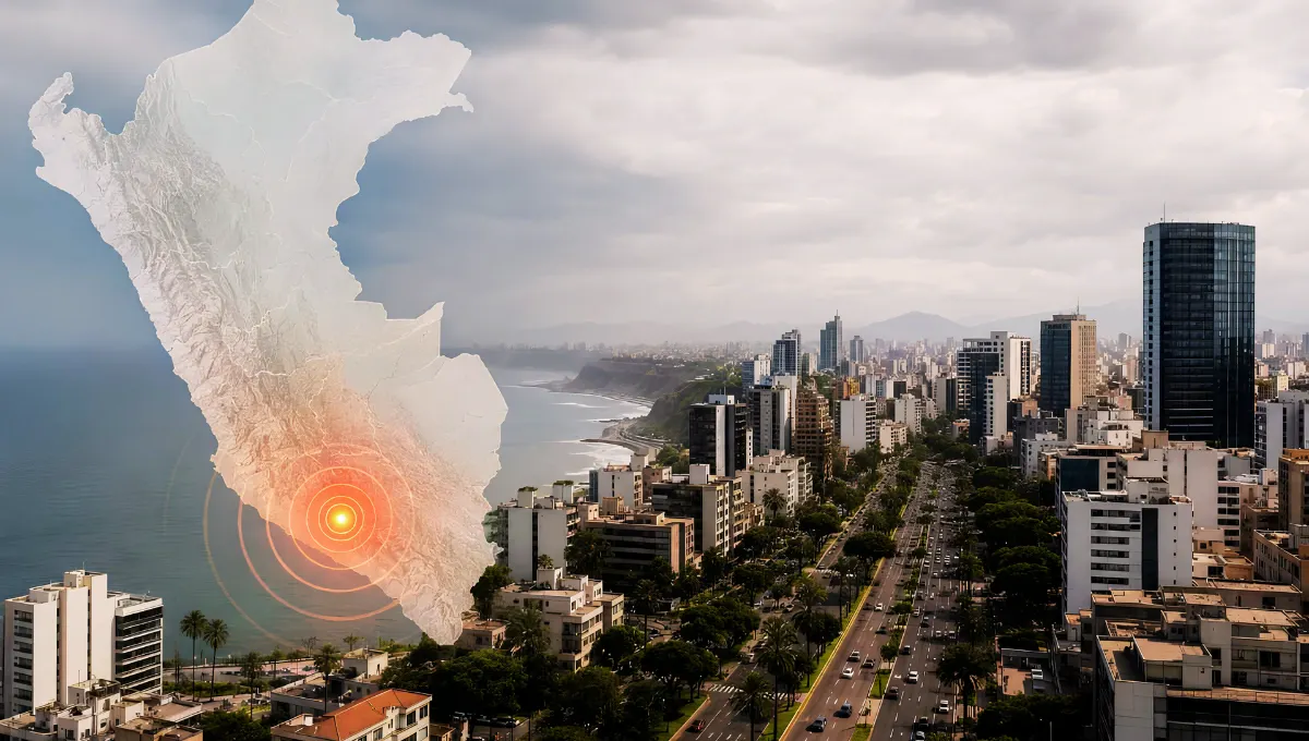
The Earthquake Struck at About 1 P.M.
The earthquake happened on Thursday, August 20, 2026, at about 1:00 p.m. local time in Peru.
The Geophysical Institute of Peru, known as IGP, recorded the exact local time as 1:00:16 p.m.
IGP measured the earthquake at magnitude 7.2.
It placed the epicenter about 35 kilometers, or 22 miles, north of Coracora in Parinacochas Province, Ayacucho.
IGP reported a depth of 108 kilometers, or about 67 miles. It listed an intensity of III–IV in Coracora.
Those numbers come directly from IGP’s official CENSIS event report.
USGS Recorded a Lower Magnitude
The U.S. Geological Survey currently lists the same earthquake at magnitude 6.7.
Its reviewed record places the earthquake about 31 kilometers, or 19 miles, northwest of Aniso, Peru.
USGS currently lists a depth of 99 kilometers, or about 62 miles.
You can follow changes on the official USGS event page.
Earlier USGS information placed the earthquake closer to Upahuacho and at a different depth.
Because earthquake records can be updated after scientists receive more data, the reviewed USGS listing should now be used instead of those earlier numbers.
Why Are the Magnitudes Different?
This is the part that confused me most.
How can one earthquake be 7.2 and 6.7?
USGS explains that earthquake agencies may use different stations, data, and calculation methods. Each agency also has its own monitoring network.
Because of this, magnitude estimates can be different.
USGS says differences of about 0.2 or 0.3 are common, even for well-recorded earthquakes.
The difference in this case is 0.5, which is larger than that common range. However, it does not automatically mean one agency made a mistake.
The most honest way to report the event is to include both measurements:
IGP: magnitude 7.2
USGS: magnitude 6.7
You can read the USGS explanation of why agency estimates differ.
Was the Earthquake Felt in Lima?
Many news reports and social media posts said the shaking was felt in Lima and several other regions.
However, the primary IGP event report only gives an intensity of III–IV in Coracora. The current USGS summary does not provide an official city-by-city list confirming Lima.
That does not mean people in Lima felt nothing.
It means I could not confirm the Lima claim through the primary event bulletins available when this article was checked.
The scientifically careful wording is:
The earthquake was reportedly felt in Lima and other regions, but the primary event bulletins reviewed here do not confirm every reported location.
The Depth May Explain the Wide Reports
Both agencies place the earthquake at a depth close to 100 kilometers.
That is much deeper than an earthquake happening close to the surface.
IGP research explains that intermediate-depth earthquakes near 100 kilometers can be felt across a large area, especially when their magnitude is higher than 5.5.
This makes reports of shaking across several regions scientifically believable.
However, it does not prove that every location named on social media experienced the same level of shaking.
You can read the related IGP research on intermediate-depth earthquakes.
Have Any Deaths or Serious Damage Been Confirmed?
The current USGS listing gives the earthquake a green PAGER alert.
That generally means the USGS model estimates a low chance of major deaths or economic losses.
However, PAGER is a computer estimate based on shaking, population, and building information. It is not the same as officials visiting communities and inspecting every building.
When this article was checked, I could not find a current primary damage bulletin from Peru’s INDECI or COEN confirming a final number of deaths, injuries, or damaged homes.
For that reason, I would not publish “no damage” or “no casualties” as a final confirmed fact yet.
The safer wording is:
No verified official casualty or damage total was available in the primary sources reviewed for this article. Local inspections may still change the situation.
Why Does Peru Have So Many Earthquakes?
Peru sits above a major plate boundary.
The oceanic Nazca Plate is moving beneath the continental South American Plate.
This process is called subduction.
Pressure and movement around these plates produce many of the earthquakes recorded in Peru.
Research published by IGP also explains that earthquakes around 100 kilometers deep can come from movement or deformation inside the Nazca Plate beneath the continent.
You can learn more from the USGS explanation of plate movement near Peru.
What Should People Do After a Strong Earthquake?
Aftershocks can happen after a major earthquake.
If shaking begins again, remember three simple steps:
Drop, cover, and hold on.
Get under a strong table if one is nearby.
Stay away from windows, glass, tall furniture, and objects that could fall.
If you are inside, do not run outside while the ground is shaking.
After the shaking stops, leave carefully if the building appears damaged. Follow instructions from local emergency officials.
The CDC’s earthquake safety guidance also warns that aftershocks may happen minutes, days, weeks, or even months after the first earthquake.
What We Know Right Now
A strong earthquake struck southern Peru at about 1:00 p.m. on August 20, 2026.
IGP measured it at magnitude 7.2 and a depth of 108 kilometers.
USGS currently lists it at magnitude 6.7 and a depth of 99 kilometers.
The different measurements are real and should both be reported with their sources.
The earthquake was widely reported as being felt across southern and central Peru, including Lima. However, complete official city-by-city shaking and damage information was not available in the primary bulletins reviewed here.
This remains a developing story.
The most important thing now is to follow IGP, INDECI, COEN, and other official Peruvian authorities for updated information.
Florida Declares State of Emergency in 25 Counties as Hurricane Isaias Threatens Gulf Coast
7 Florida Law Changes Starting This Week — Here’s What Residents Should Know

North Miami Beach Turns 100 — And It’s Throwing a Huge Free Festival This Saturday
